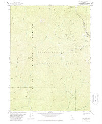
1978 Map of Dees Peak
USGS Topo · Published 1988About this map
The Salmon Trinity Alps Primitive Area defines the character of this 1970s terrain, revealing a landscape where high-altitude mining history and seasonal camps are preserved as archaeological sites. The map documents several ghost towns and historic locations identified only as sites, including White Rock City (Site), Marysville (Site), and Lake City (Site). These former settlements, along with a small Cem near White Rock City, speak to the ephemeral nature of mountain boomtowns in the California wilderness.
Find a feature on this map
47 named features on this map. Tap any name to fly to it.
Don’t see what you’re looking for? This feature index may not catch every label — zoom into the map to look around manually.
Map Details
Editions of this 1978 Dees Peak Map
3 editions found
Other maps of this area

1909 · Big Bar
USGS Topo · 1:96,000

1915 · Big Bar and Vicinity
USGS Topo · 1:250,000

1948 · Weed
USGS Topo · 1:250,000

1950 · Weed
USGS Topo · 1:250,000

1951 · Helena
USGS Topo · 1:62,500

1951 · Ironside Mountain
USGS Topo · 1:62,500

1955 · Salmon Mtn
USGS Topo · 1:62,500

1955 · Cecilville
USGS Topo · 1:62,500

1958 · Redding
USGS Topo · 1:250,000

1958 · Weed
USGS Topo · 1:250,000