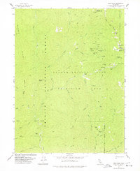
1978 Map of Dees Peak
USGS Topo · Published 1978About this map
White Rock City and Marysville stand as remnants of the mining era within the Salmon Trinity Alps Primitive Area. This 1970s survey documents a landscape where former settlements and mineral operations are reached primarily by a network of pack trails rather than modern roads. The presence of multiple sites labeled as ruins, including Old Denny and Lake City, indicates a region that once supported more active habitation, likely tied to the extraction of gold or cinnabar. The rugged terrain is defined by the New River and its tributaries, such as Battle Creek and Sherwood Creek, which cut through ridges named for local figures or terrain, like Carey Ridge and Oven Bake Ridge. The industrial history is marked by the Sherwood, Hunter, and Cinnabar mines, while small indicators of early homesteading or shelter persist at Emmons Cabin and Megram Cabin.
Find a feature on this map
49 named features on this map. Tap any name to fly to it.
Don’t see what you’re looking for? This feature index may not catch every label — zoom into the map to look around manually.
Map Details
Editions of this 1978 Dees Peak Map
3 editions found
Other maps of this area

1909 · Big Bar
USGS Topo · 1:96,000

1915 · Big Bar and Vicinity
USGS Topo · 1:250,000

1948 · Weed
USGS Topo · 1:250,000

1950 · Weed
USGS Topo · 1:250,000

1951 · Helena
USGS Topo · 1:62,500

1951 · Ironside Mountain
USGS Topo · 1:62,500

1955 · Salmon Mtn
USGS Topo · 1:62,500

1955 · Cecilville
USGS Topo · 1:62,500

1958 · Redding
USGS Topo · 1:250,000

1958 · Weed
USGS Topo · 1:250,000