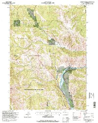
1996 Map of Munger Mountain
USGS Topo · Published 1998About this map
The Snake River carves through this Teton County landscape, marking a central corridor for recreation and infrastructure in the mid-1990s. Near the river's bend, Astoria Mineral Hot Springs and the settlement of Hoback serve as focal points for local history and community life. The terrain is largely defined by the overlapping boundaries of the Teton National Forest and the Targhee National Forest, including the Palisades Snake River Wilderness Study Area. Industrial and utilitarian activity is evident through the presence of a Rock Quarry, a Gravel Pit, and a Bureau of Public Roads Camp. Remote infrastructure is further represented by a high-elevation Lookout on Munger Mountain and a Landing Strip situated near Fall Creek, highlighting the region's reliance on both aviation and rugged access routes like the numerous 4wd tracks.
Find a feature on this map
36 named features on this map. Tap any name to fly to it.
Don’t see what you’re looking for? This feature index may not catch every label — zoom into the map to look around manually.
Map Details
Editions of this 1996 Munger Mountain Map
This is the sole edition of this map. No revisions or reprints were ever made.
Other maps of this area

1931 · Jackson
USGS Topo · 1:125,000

1935 · Jackson
USGS Topo · 1:125,000

1955 · Driggs
USGS Topo · 1:250,000

1958 · Driggs
USGS Topo · 1:250,000

1962 · Driggs
USGS Topo · 1:250,000

1963 · Munger Mountain
USGS Topo · 1:24,000

1963 · Jackson
USGS Topo · 1:24,000

1963 · Teton Pass
USGS Topo · 1:24,000

1963 · Observation Peak
USGS Topo · 1:24,000

1963 · Ferry Peak
USGS Topo · 1:24,000