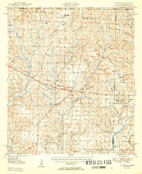
1950 Map of Munson
USGS Topo · Published 1950About this map
Munson serves as the central hub of this 1950 survey, located at the intersection of local roads and the edge of the Blackwater River State Forest. The map documents a landscape defined by forestry and small rural communities, where public services like the Munson High School and several lookout towers, including the Munson Lookout Tower and Beaver Creek Lookout Tower, reveal the infrastructure required to manage these extensive timberlands. To the north, the terrain transitions into the Conecuh National Forest at the Alabama state line.
Find a feature on this map
78 named features on this map. Tap any name to fly to it.
Don’t see what you’re looking for? This feature index may not catch every label — zoom into the map to look around manually.
Map Details
Editions of this 1950 Munson Map
2 editions found

Other maps of this area

1920 · Milton
USGS Topo · 1:62,500

1934 · Holt
USGS Topo · 1:48,000

1934 · Harold
USGS Topo · 1:62,500

1937 · Holt
USGS Topo · 1:62,500

1937 · Harold
USGS Topo · 1:62,500

1938 · Harold
USGS Topo · 1:62,500

1941 · Milton
USGS Topo · 1:62,500

1943 · Milton
USGS Topo · 1:62,500

1943 · Jay
USGS Topo · 1:62,500

1948 · Munson
USGS Topo · 1:62,500