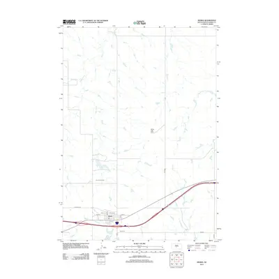
2012 Map of Murdo
USGS Topo · Published 2012About this map
Murdo serves as a vital South Dakota hub where Interstate 90 meets U.S. Route 83, anchoring a landscape defined by the intersection of prairie transportation and drainage basins. The town's grid is clearly delineated by streets such as Main St, Railroad St, and 6th St, reflecting its historical reliance on the rail corridor that parallels the modern highway. Surrounding the town site, the terrain is shaped by several watercourses including White Clay Cr and Johnny Cr, while the distinct White Clay Butte provides a prominent natural landmark to the northeast. To the south, the Murdo Cem and the Murdo Golf Course mark the edges of the community's local development. This 2012 survey illustrates the modern configuration of this Jones County seat, showing the enduring spatial relationship between the town center and the expansive drainage systems of Bull Cr and the E Fork Hay Cr.
Find a feature on this map
19 named features on this map. Tap any name to fly to it.
Don’t see what you’re looking for? This feature index may not catch every label — zoom into the map to look around manually.
Map Details
Editions of this 2012 Murdo Map
This is the sole edition of this map. No revisions or reprints were ever made.
Other maps of this area

1951 · Murdo SE
USGS Topo · 1:24,000

1951 · Murdo SW
USGS Topo · 1:24,000

1951 · Okaton SE
USGS Topo · 1:24,000

1951 · Capa SE
USGS Topo · 1:24,000

1954 · Pierre
USGS Topo · 1:250,000

1955 · Martin
USGS Topo · 1:250,000

1958 · Pierre
USGS Topo · 1:250,000

1958 · Martin
USGS Topo · 1:250,000

1972 · Draper
USGS Topo · 1:24,000

1972 · Murdo
USGS Topo · 1:24,000