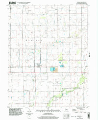
1998 Map of Murdock
USGS Topo · Published 2003About this map
Murdock and Fairland anchor this rural landscape in Douglas County, characterized by a complex infrastructure of agriculture and extraction. The map reveals the industrial footprint of the region's mining heritage through features like the Mine Shaft, Air Shaft, and a significant Mine Dump north of a local Levee. This industrial layer exists alongside the traditional markers of settlement, including Wesley Chapel and family-named burial grounds like Jordan Cem and Albin Cem. The land is drained by a network of waterways including Brushy, Fork, and the Newman Drain, while modern utility corridors are marked by extensive Pipelines and a Pumping Station. A distinct transportation element is found at the Mayhall Landing Strip, situated in the southern half of the quadrangle amidst the townships of Bowdre and Sargent.
Find a feature on this map
27 named features on this map. Tap any name to fly to it.
Don’t see what you’re looking for? This feature index may not catch every label — zoom into the map to look around manually.
Map Details
Editions of this 1998 Murdock Map
This is the sole edition of this map. No revisions or reprints were ever made.
Other maps of this area

1936 · Oakland
USGS Topo · 1:48,000

1942 · Oakland
USGS Topo · 1:62,500

1946 · Kansas
USGS Topo · 1:62,500

1949 · Kansas
USGS Topo · 1:62,500

1953 · Indianapolis
USGS Topo · 1:250,000

1956 · Indianapolis
USGS Topo · 1:250,000

1956 · Newman
USGS Topo · 1:62,500

1956 · Villa Grove
USGS Topo · 1:62,500

1957 · Indianapolis
USGS Topo · 1:250,000

1958 · Decatur
USGS Topo · 1:250,000