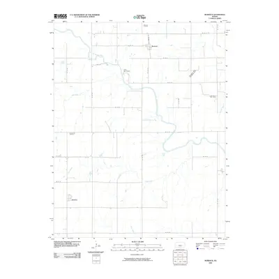
2009 Map of Murdock
USGS Topo · Published 2009About this map
The South Fork Ninnescah River meanders across the eastern half of this Kingman County landscape, defining a rural corridor punctuated by the small settlements of Murdock and Belmont. The map documents a classic Kansas agricultural and energy-producing grid, where a network of section-line roads like SE 100 Ave and SE 50 St provides access to scattered farmsteads and specialized industry. Local history is anchored at Greenwood Cemetery and Murdock Cemetery, while Camp Mennoscah occupies a bend in the river, showing the transition of riparian lands toward recreational use. This survey also records the extent of regional energy production, specifically identifying the Broadway West Oil and Gas Field and the Bolinger Oil Field, highlighting how sub-surface resources influenced the 21st-century economic footprint of this plains region.
Find a feature on this map
27 named features on this map. Tap any name to fly to it.
Don’t see what you’re looking for? This feature index may not catch every label — zoom into the map to look around manually.
Map Details
Editions of this 2009 Murdock Map
This is the sole edition of this map. No revisions or reprints were ever made.
Other maps of this area

1889 · Anthony
USGS Topo · 1:125,000

1889 · Cheney
USGS Topo · 1:125,000

1889 · Caldwell
USGS Topo · 1:125,000

1891 · Cheney
USGS Topo · 1:125,000

1891 · Anthony
USGS Topo · 1:125,000

1892 · Kingman
USGS Topo · 1:125,000

1893 · Caldwell
USGS Topo · 1:125,000

1894 · Kingman
USGS Topo · 1:125,000

1897 · Caldwell
USGS Topo · 1:125,000

1901 · Cheney
USGS Topo · 1:125,000