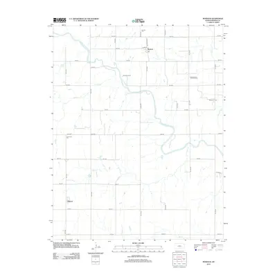
2012 Map of Murdock
USGS Topo · Published 2012About this map
The S Fork Ninnescah River meanders across this rural Kingman County landscape, anchoring a network of tributaries that includes Smoots Cr, Coon Cr, and Sand Cr. The small community of Murdock serves as a local center, supported by its namesake Murdock Cem and a nearby post office. Further south, the settlement of Belmont sits along the road grid, while Greenwood Cem provides another point of historical interest for genealogists tracing local families.
Find a feature on this map
38 named features on this map. Tap any name to fly to it.
Don’t see what you’re looking for? This feature index may not catch every label — zoom into the map to look around manually.
Map Details
Editions of this 2012 Murdock Map
This is the sole edition of this map. No revisions or reprints were ever made.
Other maps of this area

1889 · Anthony
USGS Topo · 1:125,000

1889 · Cheney
USGS Topo · 1:125,000

1889 · Caldwell
USGS Topo · 1:125,000

1891 · Cheney
USGS Topo · 1:125,000

1891 · Anthony
USGS Topo · 1:125,000

1892 · Kingman
USGS Topo · 1:125,000

1893 · Caldwell
USGS Topo · 1:125,000

1894 · Kingman
USGS Topo · 1:125,000

1897 · Caldwell
USGS Topo · 1:125,000

1901 · Cheney
USGS Topo · 1:125,000