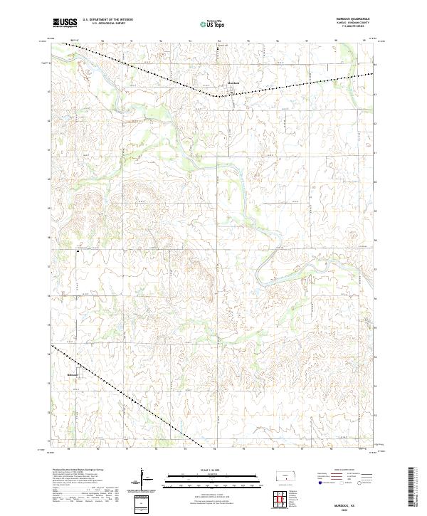
2022 Map of Murdock
USGS Topo · Published 2022About this map
The South Fork Ninnescah River meanders through this agricultural section of Kingman County, shaping the local topography of Kansas farmland. The settlement of Murdock serves as a focal point in the northeast, while the small community of Belmont is situated to the southwest. This landscape is defined by a rigorous grid of section roads, including SE 50 St and SE 110 Ave, which facilitate movement between rural homesteads and local landmarks. For those documenting family history, both Murdock Cem and Greenwood Cem are clearly marked, providing essential reference points for local genealogy. The hydrology of the region is further detailed by several tributaries, notably Smoots Cr, Coon Cr, and Big Spring Cr, which branch off from the main river corridor across the prairie.
Find a feature on this map
35 named features on this map. Tap any name to fly to it.
Don’t see what you’re looking for? This feature index may not catch every label — zoom into the map to look around manually.
Map Details
Editions of this 2022 Murdock Map
This is the sole edition of this map. No revisions or reprints were ever made.
Other maps of this area

1889 · Anthony
USGS Topo · 1:125,000

1889 · Cheney
USGS Topo · 1:125,000

1889 · Caldwell
USGS Topo · 1:125,000

1891 · Cheney
USGS Topo · 1:125,000

1891 · Anthony
USGS Topo · 1:125,000

1892 · Kingman
USGS Topo · 1:125,000

1893 · Caldwell
USGS Topo · 1:125,000

1894 · Kingman
USGS Topo · 1:125,000

1897 · Caldwell
USGS Topo · 1:125,000

1901 · Cheney
USGS Topo · 1:125,000