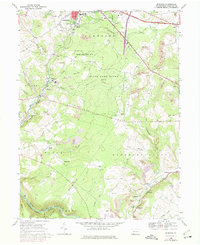
1968 Map of Murdock
USGS Topo · Published 1975About this map
State Game Lands No 50 occupies a central expanse of this Somerset County landscape, illustrating a transition from the industrial valley floors to the high timbered ridges of Negro Mountain. The map documents a mid-century period where heavy industry and rural heritage exist in close proximity. Coal extraction is evident through numerous Strip Mines and a tipple near Shober, while local transport is anchored by the Baltimore and Ohio and Western Maryland railroads. Along the Casselman River at the southern edge, a covered bridge remains a notable landmark near Burkhelder. Small settlements like Murdock, Bando, and Shamrock are clustered along the rail lines and creek valleys, often centered around local institutions such as St Johns Ch and its accompanying St Johns Cem.
Find a feature on this map
59 named features on this map. Tap any name to fly to it.
Don’t see what you’re looking for? This feature index may not catch every label — zoom into the map to look around manually.
Map Details
Editions of this 1968 Murdock Map
Other maps of this area

1913 · Somerset
USGS Topo · 1:62,500

1914 · Windber
USGS Topo · 1:62,500

1915 · Somerset
USGS Topo · 1:62,500

1916 · Windber
USGS Topo · 1:62,500

1921 · Meyersdale
USGS Topo · 1:62,500

1923 · Berlin
USGS Topo · 1:48,000

1929 · Berlin
USGS Topo · 1:62,500

1939 · Meyersdale
USGS Topo · 1:62,500

1944 · Somerset
USGS Topo · 1:62,500

1944 · Windber
USGS Topo · 1:62,500