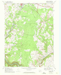
1968 Map of Murdock
USGS Topo · Published 1972About this map
Industrial and rural landscapes intersect south of the Somerset Corp Bdy during the late 1960s. The terrain is defined by the widespread footprint of coal extraction, with numerous Strip Mine operations and Quarries carved into the hillsides of Somerset and Brothersvalley townships. This heavy industry operates alongside established family-named settlements like Murdock, Althouse, and Burkhelder. Significant infrastructure, including the Pennsylvania Turnpike and a prominent Pipeline, cuts across the drainage basins of Coxes Creek and the Casselman River.
Find a feature on this map
48 named features on this map. Tap any name to fly to it.
Don’t see what you’re looking for? This feature index may not catch every label — zoom into the map to look around manually.
Map Details
Editions of this 1968 Murdock Map
Other maps of this area

1913 · Somerset
USGS Topo · 1:62,500

1914 · Windber
USGS Topo · 1:62,500

1915 · Somerset
USGS Topo · 1:62,500

1916 · Windber
USGS Topo · 1:62,500

1921 · Meyersdale
USGS Topo · 1:62,500

1923 · Berlin
USGS Topo · 1:48,000

1929 · Berlin
USGS Topo · 1:62,500

1939 · Meyersdale
USGS Topo · 1:62,500

1944 · Somerset
USGS Topo · 1:62,500

1944 · Windber
USGS Topo · 1:62,500