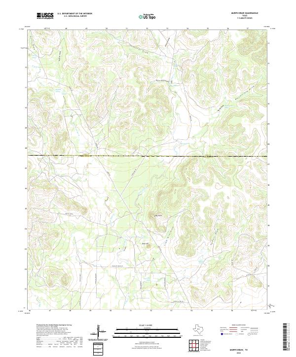
2022 Map of Murph Draw
USGS Topo · Published 2022About this map
Ruby Point and Bean Hill stand as prominent landmarks in this section of the Edwards Plateau, where the landscape is defined by an intricate network of seasonal drainage channels. The map illustrates a ranching and rural residential environment straddling the boundary of Coke County and Tom Green County. Water management and natural drainage are central to the area's geography, with the W Fork Grape Cr and E Fork Grape Cr converging toward the south near Grape Cr. A variety of named draws, including Murph Draw, Butterfield Draw, and Lime Kiln Draw, reveal the historical importance of these watercourses for navigation and land division. The road network, featuring routes like Walnut Grove and March Rd, connects isolated homesteads and grazing lands, reflecting the enduring rural character of West Texas in the early 21st century.
Find a feature on this map
31 named features on this map. Tap any name to fly to it.
Don’t see what you’re looking for? This feature index may not catch every label — zoom into the map to look around manually.
Map Details
Editions of this 2022 Murph Draw Map
This is the sole edition of this map. No revisions or reprints were ever made.
Other maps of this area

1891 · Hayrick
USGS Topo · 1:125,000

1894 · Hayrick
USGS Topo · 1:125,000

1954 · San Angelo
USGS Topo · 1:250,000

1957 · Carlsbad
USGS Topo · 1:62,500

1957 · Harriet
USGS Topo · 1:62,500

1957 · Mount Nebo
USGS Topo · 1:24,000
1957 · San Angelo North
USGS Topo · 1:24,000

1958 · San Angelo
USGS Topo · 1:250,000
1962 · Cement Mountain
USGS Topo · 1:24,000
1962 · Millican Mountains
USGS Topo · 1:24,000