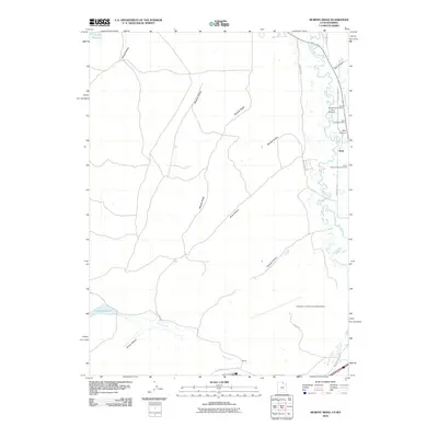
2010 Map of Murphy Ridge
USGS Topo · Published 2010About this map
The Almy coal mining district and the winding course of the Bear River dominate this landscape on the border of Utah and Wyoming. The map documents a cluster of industrial heritage sites, including the Almy Number Seven Mine, Almy Number Six Mine, and Almy Number Forty-one Mine, which speak to the area’s history of extraction. Nearby, the Almy Cemetery serves as a significant landmark for genealogists and local historians researching the families tied to these operations.
Find a feature on this map
27 named features on this map. Tap any name to fly to it.
Don’t see what you’re looking for? This feature index may not catch every label — zoom into the map to look around manually.
Map Details
Editions of this 2010 Murphy Ridge Map
This is the sole edition of this map. No revisions or reprints were ever made.
Other maps of this area

1954 · Ogden
USGS Topo · 1:250,000

1958 · Ogden
USGS Topo · 1:250,000

1960 · Ogden
USGS Topo · 1:250,000

1965 · Evanston
USGS Topo · 1:24,000

1965 · Three Forks
USGS Topo · 1:24,000

1965 · Millis
USGS Topo · 1:24,000

1968 · Wahsatch
USGS Topo · 1:24,000

1968 · Shearing Corral
USGS Topo · 1:24,000

1968 · Mc Kay Hollow
USGS Topo · 1:24,000

1968 · Neponset Reservoir NE
USGS Topo · 1:24,000