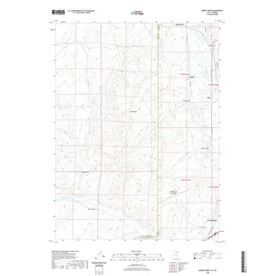
2020 Map of Murphy Ridge
USGS Topo · Published 2020About this map
The Evanston city limits and the neighboring settlement of Almy anchor the eastern edge of this modern survey along the Bear River. This corridor reflects a dense network of water management and transportation, where the historic Lincoln Highway and Almy Rd 107 parallel the river's winding path. The landscape is defined by the sharp transition from the river valley to the high ground of Murphy Ridge, which dominates the central portion of the sheet. To the south, the Evanston-Uinta County Airport Burns Field occupies a plateau above the Wasatch Cr drainage. Genealogists and local historians can locate the Almy Cem near the northern reaches of the river, while the western terrain is marked by numerous named drainages such as Murphy Hollow and Brown Hollow, which feed into the Crane Reservoir and Crane Cr system.
Find a feature on this map
33 named features on this map. Tap any name to fly to it.
Don’t see what you’re looking for? This feature index may not catch every label — zoom into the map to look around manually.
Map Details
Editions of this 2020 Murphy Ridge Map
This is the sole edition of this map. No revisions or reprints were ever made.
Other maps of this area

1954 · Ogden
USGS Topo · 1:250,000

1958 · Ogden
USGS Topo · 1:250,000

1960 · Ogden
USGS Topo · 1:250,000

1965 · Evanston
USGS Topo · 1:24,000

1965 · Three Forks
USGS Topo · 1:24,000

1965 · Millis
USGS Topo · 1:24,000

1968 · Wahsatch
USGS Topo · 1:24,000

1968 · Shearing Corral
USGS Topo · 1:24,000

1968 · Mc Kay Hollow
USGS Topo · 1:24,000

1968 · Neponset Reservoir NE
USGS Topo · 1:24,000