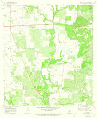
1970 Map of Murphy School
USGS Topo · Published 1973About this map
Hondo Creek and Verde Creek meander through this Medina County landscape, defining a rural territory marked by livestock and resource extraction. The Murphy Sch stands as a central community landmark near the confluence of these waterways, while a lone Cem near the northern border suggests the early settlement history of the region. The infrastructure of the era is clearly defined by the Southern Pacific railroad corridor and a major Pipeline, reflecting the industrial and transit needs of South Texas in the late 1960s.
Find a feature on this map
16 named features on this map. Tap any name to fly to it.
Don’t see what you’re looking for? This feature index may not catch every label — zoom into the map to look around manually.
Map Details
Editions of this 1970 Murphy School Map
2 editions found
Other maps of this area

1942 · Natalia
USGS Topo · 1:62,500

1954 · San Antonio
USGS Topo · 1:250,000

1956 · New Fountain
USGS Topo · 1:62,500

1957 · San Antonio
USGS Topo · 1:250,000

1964 · Riomedina
USGS Topo · 1:24,000

1964 · Castroville
USGS Topo · 1:24,000

1964 · Devine
USGS Topo · 1:24,000
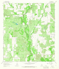
1964 · Biry
USGS Topo · 1:24,000

1964 · Yancey
USGS Topo · 1:24,000
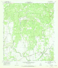
1969 · Quihi
USGS Topo · 1:24,000