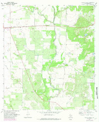
1970 Map of Murphy School
USGS Topo · Published 1982About this map
Hondo Creek and its tributaries define the drainage of this south-central Texas landscape, where the Southern Pacific rail line cuts an east-west path through the countryside. The map centers on the small rural community identified by the Murphy Sch, serving as a local focal point for the surrounding farms and ranchlands. The irrigation and water management patterns of the era are visible through features like Elm Slough and Hog Wallow Slough, which snake through the terrain alongside several Gravel Pits and scattered Oil Wells.
Find a feature on this map
20 named features on this map. Tap any name to fly to it.
Don’t see what you’re looking for? This feature index may not catch every label — zoom into the map to look around manually.
Map Details
Editions of this 1970 Murphy School Map
2 editions found
Other maps of this area

1942 · Natalia
USGS Topo · 1:62,500

1954 · San Antonio
USGS Topo · 1:250,000

1956 · New Fountain
USGS Topo · 1:62,500

1957 · San Antonio
USGS Topo · 1:250,000

1964 · Riomedina
USGS Topo · 1:24,000

1964 · Castroville
USGS Topo · 1:24,000

1964 · Devine
USGS Topo · 1:24,000
1964 · Biry
USGS Topo · 1:24,000

1964 · Yancey
USGS Topo · 1:24,000
1969 · Quihi
USGS Topo · 1:24,000