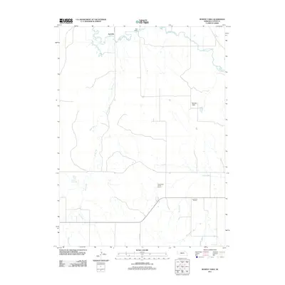
2011 Map of Murphy Table
USGS Topo · Published 2011About this map
South Loup River winds through the northern reaches of this Custer County landscape, defining a terrain characterized by the expansive Murphy Table and the distinct lowlands of Rye Valley. The area is sparsely settled, with the community of Finchville situated near the riverbanks and the Paul Ridder Ranch Airport serving as a localized hub for ranching operations. Drainage is dominated by the long course of Sand Creek, which cuts through the central and southern portions of the sheet. For those researching local lineages, the Sand Valley Cemetery provides a specific point of genealogical interest, while the presence of Stop Table Rd highlights the grid-based transport network typical of Nebraska's tableland ranching country.
Find a feature on this map
8 named features on this map. Tap any name to fly to it.
Don’t see what you’re looking for? This feature index may not catch every label — zoom into the map to look around manually.
Map Details
Editions of this 2011 Murphy Table Map
This is the sole edition of this map. No revisions or reprints were ever made.
Other maps of this area

1951 · Callaway NW
USGS Topo · 1:24,000

1951 · Callaway
USGS Topo · 1:24,000

1951 · Oconto NW
USGS Topo · 1:24,000

1954 · North Platte
USGS Topo · 1:250,000

1955 · Broken Bow
USGS Topo · 1:250,000

1956 · Broken Bow
USGS Topo · 1:250,000

1956 · North Platte
USGS Topo · 1:250,000

1957 · North Platte
USGS Topo · 1:250,000

1967 · North Platte
USGS Topo · 1:250,000
1972 · Davenport Table
USGS Topo · 1:24,000