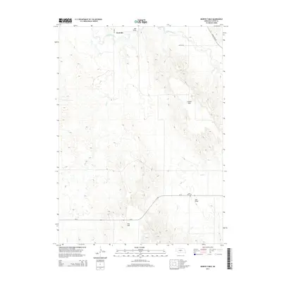
2014 Map of Murphy Table
USGS Topo · Published 2014About this map
Finchville sits near the northern edge of this Custer County landscape, where the South Loup River winds through the northern breaks. The topography is defined by significant plateau formations known locally as tables, most notably Murphy Table and Stop Table, which rise above the surrounding drainage basins. These elevated plains represent a distinct Nebraska landform where agricultural activity often concentrates away from the more broken terrain of the valleys.
Find a feature on this map
11 named features on this map. Tap any name to fly to it.
Don’t see what you’re looking for? This feature index may not catch every label — zoom into the map to look around manually.
Map Details
Editions of this 2014 Murphy Table Map
This is the sole edition of this map. No revisions or reprints were ever made.
Other maps of this area

1951 · Callaway NW
USGS Topo · 1:24,000

1951 · Callaway
USGS Topo · 1:24,000

1951 · Oconto NW
USGS Topo · 1:24,000

1954 · North Platte
USGS Topo · 1:250,000

1955 · Broken Bow
USGS Topo · 1:250,000

1956 · Broken Bow
USGS Topo · 1:250,000

1956 · North Platte
USGS Topo · 1:250,000

1957 · North Platte
USGS Topo · 1:250,000

1967 · North Platte
USGS Topo · 1:250,000
1972 · Davenport Table
USGS Topo · 1:24,000