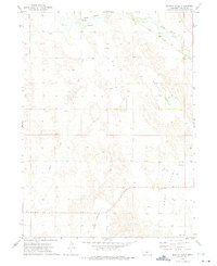
1972 Map of Murphy Table
USGS Topo · Published 1975About this map
The South Loup River meanders across the northern reaches of this Custer County landscape, shadowed by the Union Pacific railroad line. Small prairie settlements like Finchville and Milldale serve as the primary hubs in an area defined by its distinct upland topography. The map detail highlights the dramatic flat-topped landforms known locally as tables, specifically Murphy Table and Stop Table, which rise above the surrounding drainages.
Find a feature on this map
12 named features on this map. Tap any name to fly to it.
Don’t see what you’re looking for? This feature index may not catch every label — zoom into the map to look around manually.
Map Details
Editions of this 1972 Murphy Table Map
This is the sole edition of this map. No revisions or reprints were ever made.
Other maps of this area

1951 · Callaway NW
USGS Topo · 1:24,000

1951 · Callaway
USGS Topo · 1:24,000

1951 · Oconto NW
USGS Topo · 1:24,000

1954 · North Platte
USGS Topo · 1:250,000

1955 · Broken Bow
USGS Topo · 1:250,000

1956 · Broken Bow
USGS Topo · 1:250,000

1956 · North Platte
USGS Topo · 1:250,000

1957 · North Platte
USGS Topo · 1:250,000

1967 · North Platte
USGS Topo · 1:250,000
1972 · Davenport Table
USGS Topo · 1:24,000