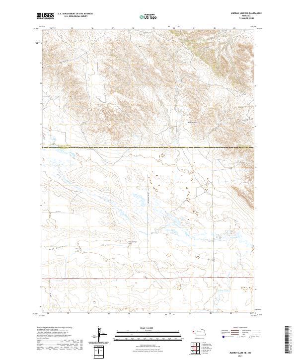
2021 Map of Murray Lake NE
USGS Topo · Published 2021About this map
Wildcat Hills dominate the northern terrain of this Nebraska landscape, where the high ridges of the escarpment drop away into the broad valley of Pumpkin Cr. This 2021 survey reveals a classic High Plains ranching environment defined by wide drainage basins and isolated topographic features like Bull Canyon and Clay Springs Draw. The map illustrates a rural infrastructure centered on large-scale land management, with long corridors such as Grandview Ranch Rd and Summit Ranch Rd providing access across the township and range lines. The jurisdictional boundary between Scotts Bluff and Banner Counties bisects the area, highlighting the transition from the rugged northern uplands to the gentler watercourses of Willow Creek in the south.
Find a feature on this map
20 named features on this map. Tap any name to fly to it.
Don’t see what you’re looking for? This feature index may not catch every label — zoom into the map to look around manually.
Map Details
Editions of this 2021 Murray Lake NE Map
This is the sole edition of this map. No revisions or reprints were ever made.
Other maps of this area

1898 · Scotts Bluff
USGS Topo · 1:125,000

1954 · Scottsbluff
USGS Topo · 1:250,000

1958 · Scottsbluff
USGS Topo · 1:250,000

1960 · Stegall
USGS Topo · 1:24,000

1960 · Murray Lake
USGS Topo · 1:24,000

1963 · Scottsbluff South
USGS Topo · 1:24,000

1963 · Roubadeau Pass
USGS Topo · 1:24,000

1973 · Scotts Bluff 4 NW
USGS Topo · 1:24,000

1973 · Scotts Bluff 4 SW
USGS Topo · 1:24,000

1973 · Scotts Bluff 3 SE
USGS Topo · 1:24,000