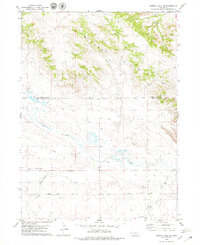
1979 Map of Murray Lake NE
USGS Topo · Published 1979About this map
The Wildcat Hills dominate the northern landscape of this Nebraska Panhandle quadrangle, creating a sharp topographical divide at the Scotts Bluff Co Banner Co line. In the late 1970s, this area remained primarily open rangeland defined by ephemeral watercourses and energy exploration. To the south, the terrain levels into the broad valley formed by Pumpkin Creek, which is paralleled by the eponymous Pumpkin Creek Road.
Find a feature on this map
13 named features on this map. Tap any name to fly to it.
Don’t see what you’re looking for? This feature index may not catch every label — zoom into the map to look around manually.
Map Details
Editions of this 1979 Murray Lake NE Map
This is the sole edition of this map. No revisions or reprints were ever made.
Other maps of this area

1898 · Scotts Bluff
USGS Topo · 1:125,000

1954 · Scottsbluff
USGS Topo · 1:250,000

1958 · Scottsbluff
USGS Topo · 1:250,000

1960 · Stegall
USGS Topo · 1:24,000

1960 · Murray Lake
USGS Topo · 1:24,000

1963 · Scottsbluff South
USGS Topo · 1:24,000

1963 · Roubadeau Pass
USGS Topo · 1:24,000

1973 · Scotts Bluff 4 NW
USGS Topo · 1:24,000

1973 · Scotts Bluff 4 SW
USGS Topo · 1:24,000

1973 · Scotts Bluff 3 SE
USGS Topo · 1:24,000