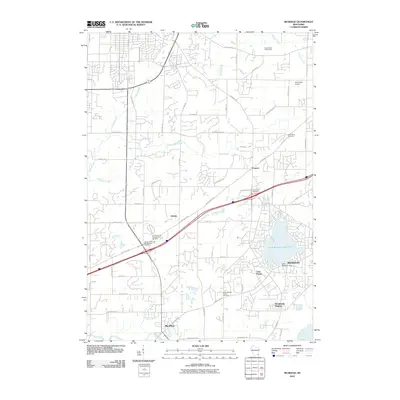
2010 Map of Muskego
USGS Topo · Published 2010About this map
Muskego and the surrounding Waukesha County landscape are defined by the prominent Little Muskego Lake and its associated Little Muskego Dam. By 2010, the area shows a distinct suburban-rural transition, where established neighborhoods like Woodcrest Heights and Lake Forest sit alongside agricultural stretches and the winding path of the Fox River near Big Bend. The map is particularly rich for genealogists, documenting numerous local burial grounds including the Vernon United Presbyterian Cemetery, Sunnyside Cemetery, and the uniquely named Jones-Muckey School Cemetery. Smaller hamlets like Guthrie, Prospect, and the community of Big Bend are linked by a maturing road network. Geographic features such as Linie Lac, Pebble Brook, and Poplar Creek drain the undulating terrain, while the Szymanski Airport and Deer Haven Golf Course reflect the modern recreational and transport footprint of this Wisconsin region.
Find a feature on this map
69 named features on this map. Tap any name to fly to it.
Don’t see what you’re looking for? This feature index may not catch every label — zoom into the map to look around manually.
Map Details
Editions of this 2010 Muskego Map
This is the sole edition of this map. No revisions or reprints were ever made.
Other maps of this area

1891 · Muskego
USGS Topo · 1:62,500

1892 · Waukesha
USGS Topo · 1:62,500

1892 · Oconomowoc
USGS Topo · 1:62,500

1892 · Eagle
USGS Topo · 1:62,500

1894 · Eagle
USGS Topo · 1:62,500

1897 · Eagle
USGS Topo · 1:62,500

1901 · Waukesha
USGS Topo · 1:62,500

1901 · Muskego
USGS Topo · 1:62,500

1906 · Eagle
USGS Topo · 1:62,500

1906 · Waukesha
USGS Topo · 1:62,500