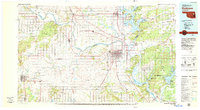
1978 Map of Muskogee
USGS Topo · Published 1979About this map
Muskogee serves as the regional hub in this late 1970s view, where the Verdigris River, Neosho River, and Arkansas River converge. This confluence, historically significant for the river-and-rail economy, is anchored by the Port of Dunkin and the specialized campus of Bacone College. The landscape is dominated by large-scale water management and recreational areas, including Fort Gibson Lake and Tenkiller Ferry Lake, alongside the extensive Gruber State Game Management Area which occupies the site of Camp Gruber (Abandoned).
Find a feature on this map
99 named features on this map. Tap any name to fly to it.
Don’t see what you’re looking for? This feature index may not catch every label — zoom into the map to look around manually.
Map Details
Editions of this 1978 Muskogee Map
This is the sole edition of this map. No revisions or reprints were ever made.
Other maps of this area

1896 · Okmulgee
USGS Topo · 1:125,000

1896 · Pryor
USGS Topo · 1:125,000

1898 · Tahlequah
USGS Topo · 1:125,000

1899 · Siloam Springs
USGS Topo · 1:125,000

1900 · Sansbois
USGS Topo · 1:125,000

1900 · Canadian
USGS Topo · 1:125,000

1900 · Wewoka
USGS Topo · 1:125,000

1900 · Okmulgee
USGS Topo · 1:125,000

1900 · Sallisaw
USGS Topo · 1:125,000

1901 · Muscogee
USGS Topo · 1:125,000