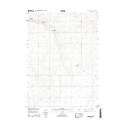
2015 Map of Muskrat Basin
USGS Topo · Published 2015About this map
Muskrat Basin defines this high-desert landscape in Fremont County, where drainage systems carve distinct patterns through the arid terrain. The prominent escarpment of Beaver Rim cuts across the southeastern portion of the map, serving as a significant geographical divide. Water management and natural runoff are central to the area's character, with Muskrat Creek and its many tributaries, including Cottonwood Draw and Buffalo Creek, dictating the local topography. In the north, the headwaters of the Middle Fork and East Fork Horseshoe Draws show the intricate erosional features of the basin. Human presence is sparse, marked primarily by the utility of Ore Road and various 4WD tracks that navigate the section lines of the Public Land Survey System, reflecting the area's history of mineral exploration and ranching access.
Find a feature on this map
14 named features on this map. Tap any name to fly to it.
Don’t see what you’re looking for? This feature index may not catch every label — zoom into the map to look around manually.
Map Details
Editions of this 2015 Muskrat Basin Map
This is the sole edition of this map. No revisions or reprints were ever made.
Other maps of this area

1951 · Stampede Meadow
USGS Topo · 1:24,000

1951 · Black Rock Gap
USGS Topo · 1:24,000

1951 · Graham Ranch
USGS Topo · 1:24,000

1952 · Tin Cup Mountain
USGS Topo · 1:24,000

1952 · Muskrat Basin
USGS Topo · 1:24,000

1952 · Rongis Reservoir SE
USGS Topo · 1:24,000

1952 · Rongis Reservoir
USGS Topo · 1:24,000

1952 · Puddle Springs
USGS Topo · 1:24,000

1952 · Coyote Springs
USGS Topo · 1:24,000

1955 · Casper
USGS Topo · 1:250,000