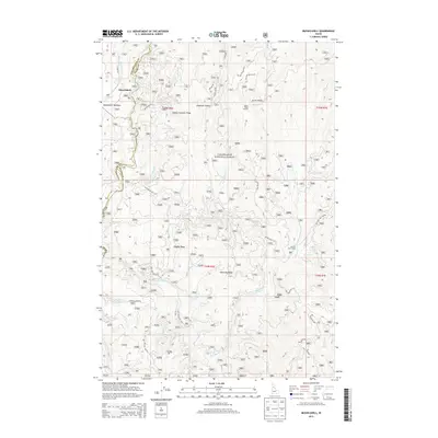
2013 Map of Musselshell
USGS Topo · Published 2013About this map
Clearwater National Forest dominates this Idaho landscape, where the Musselshell settlement and Musselshell Meadows sit at the western edge of a complex network of ridges and drainage basins. High points like Austin Ridge and Eldorado Ridge define the vertical relief, with the Austin Ridge Lookout providing a central vantage point over the timbered slopes. The area is defined by its water system, as Lolo Cr, Musselshell Cr, and Eldorado Cr carve through the terrain, joined by numerous named tributaries like White Cr and Utah Cr. A dense system of forest development roads, including the Musselshell Rd, connects remote sites such as Clark Tree and Salmon Trout Camp. This survey reflects the modern management of these high-altitude Idaho lands, where specialized outposts and camps serve as the primary human footprint amidst the peaks of Chamook Ridge and Chamook Saddle.
Find a feature on this map
62 named features on this map. Tap any name to fly to it.
Don’t see what you’re looking for? This feature index may not catch every label — zoom into the map to look around manually.
Map Details
Editions of this 2013 Musselshell Map
This is the sole edition of this map. No revisions or reprints were ever made.
Other maps of this area

1924 · Weippe
USGS Topo · 1:125,000

1956 · Hamilton
USGS Topo · 1:250,000

1959 · Hamilton
USGS Topo · 1:250,000

1960 · Hamilton
USGS Topo · 1:250,000

1964 · Hamilton
USGS Topo · 1:250,000

1966 · Pierce
USGS Topo · 1:24,000
1966 · Glenwood
USGS Topo · 1:24,000
1966 · Hemlock Butte
USGS Topo · 1:24,000

1966 · Lowell
USGS Topo · 1:24,000
1966 · Snowy Summit
USGS Topo · 1:24,000