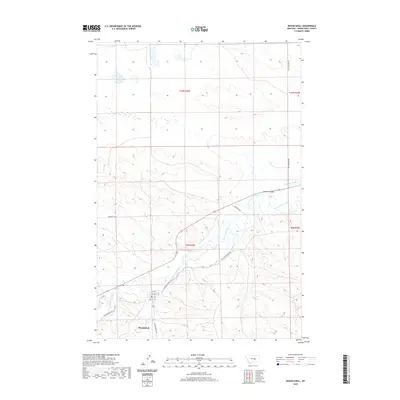
2020 Map of Musselshell
USGS Topo · Published 2020About this map
Musselshell sits along a bend in the Musselshell River, serving as a focal point for this rural Montana landscape. The map illustrates a developed irrigation and transport network characteristic of the region's agricultural roots, including the Chandler Ditch and a grid of local thoroughfares such as 1st Ave and 2nd Ave. The surrounding terrain is defined by drainage features like McLean Coulee and Hawk Cr, which carve through the high plains. Historically significant routes like Old Musselshell Rd and Ragged Point Rd connect distant ranches and grazing lands to the central river valley, reflecting the enduring spatial patterns of central Montana’s livestock and farming economy.
Find a feature on this map
20 named features on this map. Tap any name to fly to it.
Don’t see what you’re looking for? This feature index may not catch every label — zoom into the map to look around manually.
Map Details
Editions of this 2020 Musselshell Map
This is the sole edition of this map. No revisions or reprints were ever made.
Other maps of this area

1954 · Forsyth
USGS Topo · 1:250,000

1954 · Roundup
USGS Topo · 1:250,000

1957 · Forsyth
USGS Topo · 1:250,000

1958 · Roundup
USGS Topo · 1:250,000

1958 · Forsyth
USGS Topo · 1:250,000

1962 · Queens Point
USGS Topo · 1:24,000

1962 · Melstone NW
USGS Topo · 1:24,000

1963 · Musselshell
USGS Topo · 1:24,000
1963 · Akers Ranch
USGS Topo · 1:24,000

1963 · Musselshell NW
USGS Topo · 1:24,000