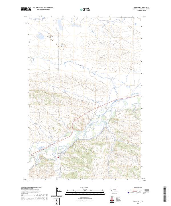
2024 Map of Musselshell
USGS Topo · Published 2024About this map
Musselshell sits at a geographic crossroads in central Montana, anchored by the winding course of the Musselshell River. This map shows a landscape defined by water management and transit, where the Chandler Ditch and the drainage of McLean Coulee feed into the river valley. The small settlement is clearly marked with its local street grid, including 1st Ave and 2nd Ave, and features the local Po (Post Office) as a central landmark for researchers. Surrounding the town, the terrain transitions into complex drainage systems like Hawk Creek and Sand Creek. Long-established routes such as Ragged Point Rd and Old Musselshell Rd follow the natural topography, tracing the valley floor and connecting the remote township to the broader cattle and ranching country of the region.
Find a feature on this map
19 named features on this map. Tap any name to fly to it.
Don’t see what you’re looking for? This feature index may not catch every label — zoom into the map to look around manually.
Map Details
Editions of this 2024 Musselshell Map
This is the sole edition of this map. No revisions or reprints were ever made.
Other maps of this area

1954 · Forsyth
USGS Topo · 1:250,000

1954 · Roundup
USGS Topo · 1:250,000

1957 · Forsyth
USGS Topo · 1:250,000

1958 · Roundup
USGS Topo · 1:250,000

1958 · Forsyth
USGS Topo · 1:250,000

1962 · Queens Point
USGS Topo · 1:24,000

1962 · Melstone NW
USGS Topo · 1:24,000

1963 · Musselshell
USGS Topo · 1:24,000
1963 · Akers Ranch
USGS Topo · 1:24,000

1963 · Musselshell NW
USGS Topo · 1:24,000