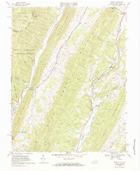
1969 Map of Mustoe
USGS Topo · Published 1984About this map
Lantz Mountain and Back Creek Mountain dominate the topography of this Highland County landscape, carved by the parallel courses of the Jackson River and Back Creek. Small agricultural settlements like Mustoe and Valley Center anchor the valley floors, where rural life is documented through landmarks like Green Hill Ch, Victory Chapel, and Beulah Ch. The boundary between Pocahontas and Highland counties marks the transition from Virginia into West Virginia along the western edge of the survey.
Find a feature on this map
41 named features on this map. Tap any name to fly to it.
Don’t see what you’re looking for? This feature index may not catch every label — zoom into the map to look around manually.
Map Details
Editions of this 1969 Mustoe Map
Other maps of this area

1901 · Monterey
USGS Topo · 1:125,000

1922 · Cass
USGS Topo · 1:48,000

1923 · Warm Springs
USGS Topo · 1:48,000

1924 · Cass
USGS Topo · 1:62,500

1926 · Warm Springs
USGS Topo · 1:62,500

1941 · Monterey
USGS Topo · 1:62,500

1944 · Monterey
USGS Topo · 1:62,500

1946 · Warm Springs
USGS Topo · 1:62,500

1946 · Williamsville
USGS Topo · 1:62,500

1949 · Charlottesville
USGS Topo · 1:250,000