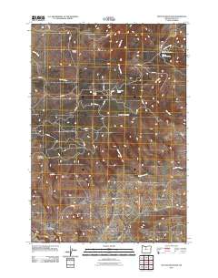
2011 Map of Mutton Mountain
USGS Topo · Published 2011About this map
Mutton Mountains define this high-desert landscape in Wasco County, where the network of Bureau of Indian Affairs (BIA) and service roads reveals a long history of ranching and land management. The presence of multiple historic sites like Mutton Mountain Corral, Eagle Springs Corral, and Charley Corral indicates the importance of livestock grazing across these ridges. Water sources are critical in this terrain, as evidenced by Little Fawn Spring and Mutton Mountain Spring, which feed into the rugged drainages of Eagle Creek and Skookum Creek. To the north, the elevation rises toward Shaniko Butte, while the southwestern corner features the notable landform known as Hellgate. This 2011 survey captures the specialized infrastructure of a working landscape, where the naming of remote corrals like Wire Corral speaks to a legacy of range life.
Find a feature on this map
40 named features on this map. Tap any name to fly to it.
Don’t see what you’re looking for? This feature index may not catch every label — zoom into the map to look around manually.
Map Details
Editions of this 2011 Mutton Mountain Map
This is the sole edition of this map. No revisions or reprints were ever made.
Other maps of this area

1928 · Madras
USGS Topo · 1:125,000

1930 · Dufur
USGS Topo · 1:125,000

1931 · Madras
USGS Topo · 1:125,000

1934 · Dufur
USGS Topo · 1:125,000

1953 · The Dalles
USGS Topo · 1:250,000

1955 · Bend
USGS Topo · 1:250,000

1956 · The Dalles
USGS Topo · 1:250,000

1957 · Bend
USGS Topo · 1:250,000

1957 · The Dalles
USGS Topo · 1:250,000

1958 · Bend
USGS Topo · 1:250,000