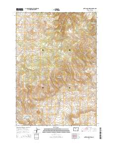
2014 Map of Mutton Mountain
USGS Topo · Published 2014About this map
Mutton Mountains dominate this high-desert terrain in north-central Oregon, where the landscape is defined by a network of drainage systems and isolated springs. The topography transitions from the heights of Shaniko Butte in the north toward the deep incision of Indian Head Canyon and the narrows at Hellgate to the south. This area is characterized by an intricate web of service roads, including Bia-3 and numerous numbered routes like S-334 RD, which navigate the complex ridges and basins. Water sources are critical landmarks in this environment, evidenced by the presence of Mutton Mountain Spring, Eagle Springs, and Little Basin Spring. These features, along with seasonal watercourses like Skookum Cr and Antoken Cr, illustrate the fundamental importance of hydrology in shaping access and movement across this portion of Wasco County.
Find a feature on this map
39 named features on this map. Tap any name to fly to it.
Don’t see what you’re looking for? This feature index may not catch every label — zoom into the map to look around manually.
Map Details
Editions of this 2014 Mutton Mountain Map
This is the sole edition of this map. No revisions or reprints were ever made.
Other maps of this area

1928 · Madras
USGS Topo · 1:125,000

1930 · Dufur
USGS Topo · 1:125,000

1931 · Madras
USGS Topo · 1:125,000

1934 · Dufur
USGS Topo · 1:125,000

1953 · The Dalles
USGS Topo · 1:250,000

1955 · Bend
USGS Topo · 1:250,000

1956 · The Dalles
USGS Topo · 1:250,000

1957 · Bend
USGS Topo · 1:250,000

1957 · The Dalles
USGS Topo · 1:250,000

1958 · Bend
USGS Topo · 1:250,000