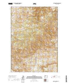
2020 Map of Mutton Mountain
USGS Topo · Published 2020About this map
Mutton Mountains define the high country of Wasco County in this 2020 topographic study, which reveals a complex network of forest and service roads threading through the high desert terrain. The map details a landscape where water is the primary architect of the geography, from the deep incision of Indian Head Canyon to the essential water sources like Mutton Mountain Spring, Eagle Springs, and Little Eagle Spring.
Find a feature on this map
42 named features on this map. Tap any name to fly to it.
Don’t see what you’re looking for? This feature index may not catch every label — zoom into the map to look around manually.
Map Details
Editions of this 2020 Mutton Mountain Map
This is the sole edition of this map. No revisions or reprints were ever made.
Other maps of this area

1928 · Madras
USGS Topo · 1:125,000

1930 · Dufur
USGS Topo · 1:125,000

1931 · Madras
USGS Topo · 1:125,000

1934 · Dufur
USGS Topo · 1:125,000

1953 · The Dalles
USGS Topo · 1:250,000

1955 · Bend
USGS Topo · 1:250,000

1956 · The Dalles
USGS Topo · 1:250,000

1957 · Bend
USGS Topo · 1:250,000

1957 · The Dalles
USGS Topo · 1:250,000

1958 · Bend
USGS Topo · 1:250,000