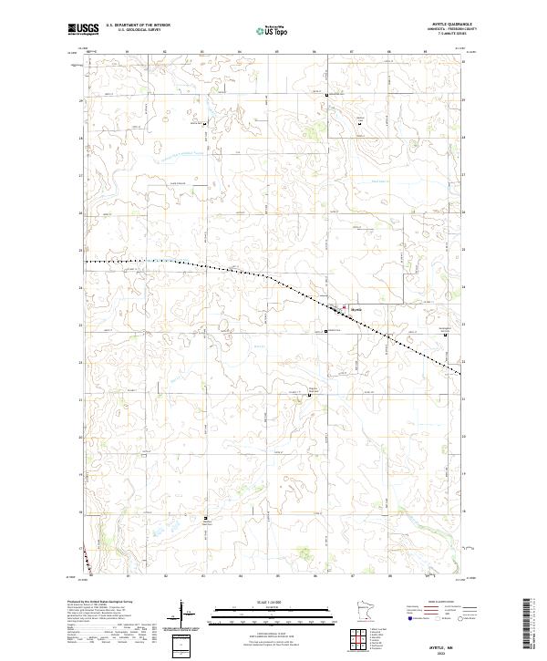
2022 Map of Myrtle
USGS Topo · Published 2022About this map
Myrtle serves as the central hub of this agricultural landscape in Freeborn County, characterized by a complex network of managed waterways and small community burial grounds. The land is defined by drainage systems such as Judicial Ditch Number Twenty and County Ditch Number Fortynine, which reflect the region's intensive engineering for farming. These man-made channels intersect with natural flows like Peter Lund Cr and Deer Cr. Genealogy researchers will find a significant concentration of local cemeteries that speak to the area's diverse ethnic heritage, including the Bohemian Cem and the Danish Cem. Other smaller family or community plots like Krikva Cem, Kestner Cem, and the poignantly named Mockingbird Hill Cem are scattered across the township grid, often located near arterial routes like Clark Cipra Rd or Co Hwy 13.
Find a feature on this map
32 named features on this map. Tap any name to fly to it.
Don’t see what you’re looking for? This feature index may not catch every label — zoom into the map to look around manually.
Map Details
Editions of this 2022 Myrtle Map
This is the sole edition of this map. No revisions or reprints were ever made.
Other maps of this area

1954 · Albert Lea
USGS Topo · 1:62,500

1954 · Hayward
USGS Topo · 1:62,500

1954 · Mason City
USGS Topo · 1:250,000

1957 · Mason City
USGS Topo · 1:250,000

1958 · Mason City
USGS Topo · 1:250,000

1972 · Northwood
USGS Topo · 1:24,000

1972 · Fertile NE
USGS Topo · 1:24,000
1972 · Carpenter
USGS Topo · 1:24,000

1982 · Hayward
USGS Topo · 1:24,000
1982 · London
USGS Topo · 1:24,000