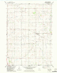
1982 Map of Myrtle
USGS Topo · Published 1983About this map
Myrtle and Gordonsville sit within a strictly surveyed grid of southern Minnesota farmland just north of the Iowa border. The landscape is defined by its agricultural utility, evidenced by the extensive network of drainage projects such as Judicial Ditch No 20, Judicial Ditch No 49, and Judicial Ditch No 75. This system manages the flow across the townships of Hayward, Oakland, Shell Rock, and London, where natural features like Peter Lund Creek and Mud Lake persist amid the straightened waterways.
Find a feature on this map
24 named features on this map. Tap any name to fly to it.
Don’t see what you’re looking for? This feature index may not catch every label — zoom into the map to look around manually.
Map Details
Editions of this 1982 Myrtle Map
This is the sole edition of this map. No revisions or reprints were ever made.
Other maps of this area

1954 · Albert Lea
USGS Topo · 1:62,500

1954 · Hayward
USGS Topo · 1:62,500

1954 · Mason City
USGS Topo · 1:250,000

1957 · Mason City
USGS Topo · 1:250,000

1958 · Mason City
USGS Topo · 1:250,000

1972 · Northwood
USGS Topo · 1:24,000

1972 · Fertile NE
USGS Topo · 1:24,000
1972 · Carpenter
USGS Topo · 1:24,000

1982 · Hayward
USGS Topo · 1:24,000
1982 · London
USGS Topo · 1:24,000