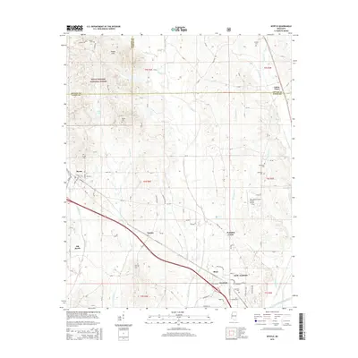
2015 Map of Myrtle
USGS Topo · Published 2015About this map
New Albany and its surrounding communities in Union County sit at a crossroads of commerce and terrain in this modern survey. The map details the transition from the wooded elevations of the Holly Springs National Forest in the northwest to the bottomlands along the Little Tallahatchie River. Transportation corridors define the region, with MS-178 and several county roads connecting the settlements of Myrtle, Glenfield, and Cotton Plant.
Find a feature on this map
116 named features on this map. Tap any name to fly to it.
Don’t see what you’re looking for? This feature index may not catch every label — zoom into the map to look around manually.
Map Details
Editions of this 2015 Myrtle Map
This is the sole edition of this map. No revisions or reprints were ever made.
Other maps of this area

1949 · New Albany
USGS Topo · 1:62,500

1951 · New Albany
USGS Topo · 1:62,500

1955 · Ripley
USGS Topo · 1:62,500

1955 · Sherman
USGS Topo · 1:62,500

1955 · Blue Mountain
USGS Topo · 1:62,500

1956 · Tupelo
USGS Topo · 1:250,000

1958 · Tupelo
USGS Topo · 1:250,000

1980 · New Albany West
USGS Topo · 1:24,000
1980 · New Albany East
USGS Topo · 1:24,000
1980 · Etta
USGS Topo · 1:24,000