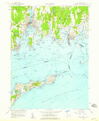
1958 Map of Mystic
USGS Topo · Published 1959About this map
Maritime heritage and complex coastal geography define the shoreline between Groton and Stonington in the late 1950s. The village of Mystic serves as a central hub, split by the Mystic River and surrounded by numerous protected inlets like Beebe Cove and Quiambog Cove. The landscape is dotted with ancestral markers, from the large Elm Grove Cemetery to smaller family sites like Packer Cem and Miner Cem.
Find a feature on this map
71 named features on this map. Tap any name to fly to it.
Don’t see what you’re looking for? This feature index may not catch every label — zoom into the map to look around manually.
Map Details
Editions of this 1958 Mystic Map
Other maps of this area

1889 · Stonington
USGS Topo · 1:62,500

1892 · New London
USGS Topo · 1:62,500

1893 · Stonington
USGS Topo · 1:62,500

1893 · New London
USGS Topo · 1:62,500

1903 · Gardiners Island
USGS Topo · 1:62,500

1904 · Gardiners Island
USGS Topo · 1:62,500

1904 · Montauk
USGS Topo · 1:62,500

1921 · Gardiners Island
USGS Topo · 1:62,500

1921 · New London
USGS Topo · 1:62,500

1921 · Stonington
USGS Topo · 1:62,500