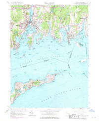
1958 Map of Mystic
USGS Topo · Published 1970About this map
The maritime identity of coastal New London County is defined by the Mystic River and the bustling harbors that supported a legacy of shipbuilding and trade. This survey highlights the classic shoreline of Mystic, West Mystic, and Stonington, where the Penn Central railroad tracks skirt the edge of the Fishers Island Sound. Cultural landmarks like Mystic Seaport stand alongside industrial and civic infrastructure, including the Mystic Reservoir and the Stonington Landing Field.
Find a feature on this map
100 named features on this map. Tap any name to fly to it.
Don’t see what you’re looking for? This feature index may not catch every label — zoom into the map to look around manually.
Map Details
Editions of this 1958 Mystic Map
Other maps of this area

1889 · Stonington
USGS Topo · 1:62,500

1892 · New London
USGS Topo · 1:62,500

1893 · Stonington
USGS Topo · 1:62,500

1893 · New London
USGS Topo · 1:62,500

1903 · Gardiners Island
USGS Topo · 1:62,500

1904 · Gardiners Island
USGS Topo · 1:62,500

1904 · Montauk
USGS Topo · 1:62,500

1921 · Gardiners Island
USGS Topo · 1:62,500

1921 · New London
USGS Topo · 1:62,500

1921 · Stonington
USGS Topo · 1:62,500