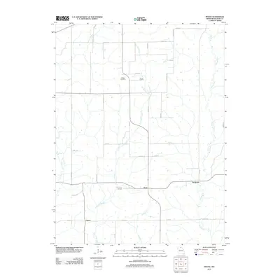
2012 Map of Mystic
USGS Topo · Published 2012About this map
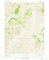
Mystic and the surrounding rural landscape of Sullivan County are defined by the winding paths of East Yellow Creek and the Mussel Fork. This Missouri quadrangle reflects a deeply rooted agricultural layout, where a network of local roads like Omaha Rd and Gully Rd connects dispersed farmsteads and small settlements. For those researching local family history, the map includes Springer Cemetery and Pleasantville Cemetery, providing clear geographic markers for genealogy studies. The drainage patterns of John Branch and West Yellow Creek further shape the terrain, illustrating the water-dependent nature of the region's historical development. Small communities such as Sticklerville and Owasco remain as central points in this quiet corner of the state, while the Carter Lake Dam represents a notable hydrological feature in the northern portion of the survey.
Find a feature on this map
39 named features on this map. Tap any name to fly to it.
Don’t see what you’re looking for? This feature index may not catch every label — zoom into the map to look around manually.
Map Details
Editions of this 2012 Mystic Map
This is the sole edition of this map. No revisions or reprints were ever made.
Other maps of this area

1912 · Green City
USGS Topo · 1:62,500

1914 · Green City
USGS Topo · 1:62,500

1954 · Centerville
USGS Topo · 1:250,000

1957 · Centerville
USGS Topo · 1:250,000

1958 · Centerville
USGS Topo · 1:250,000

1963 · Pure Air
USGS Topo · 1:24,000
1963 · Nind
USGS Topo · 1:24,000
1963 · Mystic
USGS Topo · 1:24,000
1963 · Winigan
USGS Topo · 1:24,000
1964 · Milan SE
USGS Topo · 1:24,000