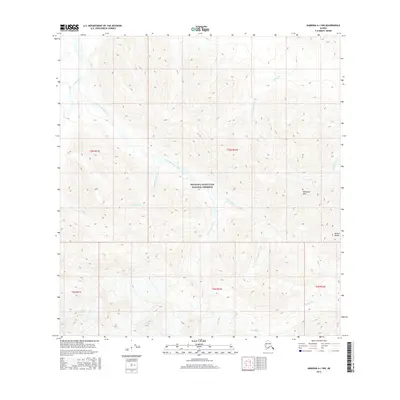
2016 Map of Nabesna A-1 NW
USGS Topo · Published 2016About this map
The Wrangell-Saint Elias National Preserve encompasses most of this landscape, where the glacial and river systems of interior Alaska define the terrain. High-altitude features like Wellesley Mtn and the northern reaches of the Alaska Range overlook a complex network of drainage basins. The map illustrates a transitional environment where the Carl Glacier feeds into numerous named watercourses, including Snag Creek and its major tributaries, East Fork Snag Creek and the E Fork Snag Cr. This 2016 survey captures the area's wilderness character through its intricate hydrology, following the paths of Reynolds Creek, Crescent Creek, and Carden Creek as they carve through the mountain slopes. The lack of man-made infrastructure emphasizes the preservation of this remote ecosystem near the international border.
Find a feature on this map
17 named features on this map. Tap any name to fly to it.
Don’t see what you’re looking for? This feature index may not catch every label — zoom into the map to look around manually.
Map Details
Editions of this 2016 Nabesna A-1 NW Map
This is the sole edition of this map. No revisions or reprints were ever made.
Other maps of this area

1950 · Nabesna
USGS Topo · 1:250,000

1951 · Nabesna
USGS Topo · 1:250,000

1959 · Nabesna A-1
USGS Topo · 1:63,360

1960 · Nabesna A-2
USGS Topo · 1:63,360

1960 · Nabesna B-2
USGS Topo · 1:63,360

1960 · Nabesna
USGS Topo · 1:250,000

1960 · Nabesna B-1
USGS Topo · 1:63,360
2016 · Nabesna A-2 NE
USGS Topo · 1:25,000
2016 · Nabesna B-2 SE
USGS Topo · 1:25,000
2016 · Nabesna B-1 SW
USGS Topo · 1:25,000