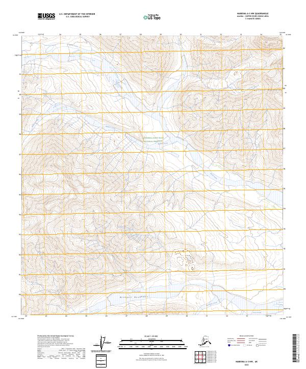
2023 Map of Nabesna A-3 NW
USGS Topo · Published 2023About this map
The Nutzotin Mountains and the Wrangell Mountains dominate this high-altitude landscape in the Copper River Census Area. This region of interior Alaska is defined by its massive glacial drainage systems, with the northern slopes feeding into Notch Creek and William Creek, while the southern reaches flow toward Cross Creek and Ramshole Creek. The map documents a critical intersection of federal land designations, bisected by the boundary between the Wrangell-Saint Elias National Preserve and the more strictly protected Wrangell-St. Elias Wilderness. This 2023 survey illustrates the dramatic topography of the Alaska Range where alpine peaks give way to braided stream beds, providing a contemporary view of these protected public lands without the imprint of modern infrastructure or road networks.
Find a feature on this map
13 named features on this map. Tap any name to fly to it.
Don’t see what you’re looking for? This feature index may not catch every label — zoom into the map to look around manually.
Map Details
Editions of this 2023 Nabesna A-3 NW Map
This is the sole edition of this map. No revisions or reprints were ever made.
Other maps of this area

1950 · Nabesna
USGS Topo · 1:250,000

1951 · Nabesna
USGS Topo · 1:250,000

1959 · Nabesna A-4
USGS Topo · 1:63,360

1960 · Nabesna B-4
USGS Topo · 1:63,360

1960 · Nabesna A-3
USGS Topo · 1:63,360

1960 · Nabesna
USGS Topo · 1:250,000

1960 · Nabesna B-3
USGS Topo · 1:63,360
2016 · Nabesna B-3 SE
USGS Topo · 1:25,000
2016 · Nabesna B-4 SE
USGS Topo · 1:25,000
2016 · Nabesna A-4 NE
USGS Topo · 1:25,000