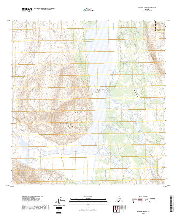
2023 Map of Nabesna A-3 SE
USGS Topo · Published 2023About this map
Chisana sits at the heart of this high-alpine landscape, serving as a rare point of human settlement within the expansive Wrangell-Saint Elias National Preserve. The town is supported by the Chisana Airport, which provides a vital link to the interior where the Chisana River meets its glacial origins. The topography is dominated by the intersection of the Wrangell Mountains and the Nutzotin Mountains, with prominent peaks like Euchre Mtn rising above the river valleys.
Find a feature on this map
23 named features on this map. Tap any name to fly to it.
Don’t see what you’re looking for? This feature index may not catch every label — zoom into the map to look around manually.
Map Details
Editions of this 2023 Nabesna A-3 SE Map
This is the sole edition of this map. No revisions or reprints were ever made.
Other maps of this area

1950 · Nabesna
USGS Topo · 1:250,000

1951 · McCarthy
USGS Topo · 1:250,000

1951 · Nabesna
USGS Topo · 1:250,000

1959 · McCarthy D-3
USGS Topo · 1:63,360

1960 · Nabesna A-3
USGS Topo · 1:63,360

1960 · Nabesna A-2
USGS Topo · 1:63,360

1960 · Nabesna
USGS Topo · 1:250,000

1960 · McCarthy D-4
USGS Topo · 1:63,360

1960 · McCarthy
USGS Topo · 1:250,000
2016 · Nabesna A-2 NW
USGS Topo · 1:25,000