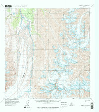
1959 Map of Nabesna A-4
USGS Topo · Published 1975About this map
Nabesna Glacier and the wide, braided channels of the Nabesna River dominate this 1950s landscape, providing a clear look at the glacial dynamics and rugged geography of this Alaskan interior region. The map captures a moment of early industrial and logistical activity, centered on Orange Hill where Quarries and the Orange Hill Landing Strip indicate localized resource exploration. A solitary Tractor Trail winds through the terrain, suggesting the difficult overland routes required for transport during this era. High-elevation ice fields such as Nikonda Glacier and Cross Creek Glacier feed into numerous drainage systems, including Monte Cristo Creek and Bond Creek. This document serves as a detailed baseline for studying the shifting margins of massive ice bodies and the early footprints of mining infrastructure in a largely untracked wilderness.
Find a feature on this map
15 named features on this map. Tap any name to fly to it.
Don’t see what you’re looking for? This feature index may not catch every label — zoom into the map to look around manually.
Map Details
Editions of this 1959 Nabesna A-4 Map
3 editions found
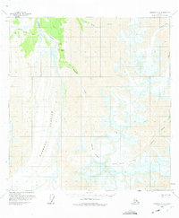
Other maps of this area

1950 · Nabesna
USGS Topo · 1:250,000

1951 · McCarthy
USGS Topo · 1:250,000

1951 · Nabesna
USGS Topo · 1:250,000

1959 · Nabesna A-4
USGS Topo · 1:63,360

1959 · Nabesna A-5
USGS Topo · 1:63,360

1960 · Nabesna B-4
USGS Topo · 1:63,360

1960 · Nabesna B-5
USGS Topo · 1:63,360

1960 · Nabesna A-3
USGS Topo · 1:63,360

1960 · McCarthy D-6
USGS Topo · 1:63,360

1960 · Nabesna
USGS Topo · 1:250,000