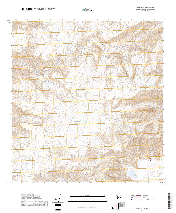
2023 Map of Nabesna A-5 SE
USGS Topo · Published 2023About this map
Wrangell Mountains dominate this high-altitude landscape in the Copper River Census Area, where glacial movement continues to carve the alpine terrain. This modern survey illustrates the critical boundary between the Wrangell-St. Elias Wilderness and the Wrangell-Saint Elias National Preserve, a division reflecting decades of conservation management in the Alaskan interior. The southeastern corner is marked by the presence of the Nabesna Glacier, providing a detailed view of its current extent and the surrounding moraine and ice-field patterns. The absence of roads or permanent structures underscores the isolation of this protected wilderness, where navigation relies entirely on natural landmarks and elevation contours.
Find a feature on this map
8 named features on this map. Tap any name to fly to it.
Don’t see what you’re looking for? This feature index may not catch every label — zoom into the map to look around manually.
Map Details
Editions of this 2023 Nabesna A-5 SE Map
This is the sole edition of this map. No revisions or reprints were ever made.
Other maps of this area

1950 · Nabesna
USGS Topo · 1:250,000

1951 · McCarthy
USGS Topo · 1:250,000

1951 · Nabesna
USGS Topo · 1:250,000

1959 · Nabesna A-4
USGS Topo · 1:63,360

1959 · McCarthy D-7
USGS Topo · 1:63,360

1959 · Nabesna A-5
USGS Topo · 1:63,360

1960 · McCarthy D-6
USGS Topo · 1:63,360

1960 · Nabesna
USGS Topo · 1:250,000

1960 · McCarthy
USGS Topo · 1:250,000
2016 · Nabesna A-4 NW
USGS Topo · 1:25,000