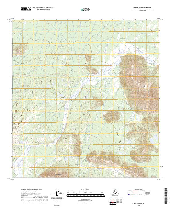
2023 Map of Nabesna B-1 SW
USGS Topo · Published 2023About this map
Snag Creek meanders through this interior Alaskan wilderness, cutting a wide valley between the high reaches of the Carden Hills to the east and the looming Nutzotin Mountains along the southern edge. The map captures a significant portion of the Wrangell-Saint Elias National Preserve, a landscape defined by its high-elevation drainage patterns and absence of modern infrastructure. The detailed contouring reveals the complex topography of the Northeast Fairbanks Census Area, where glacial-carved ridges and alluvial basins remain largely untouched. For researchers, this survey provides a precise record of the hydrological network and terrain of this protected area in the early twenty-first century, documenting the natural landforms that dictate movement through the subarctic interior.
Find a feature on this map
10 named features on this map. Tap any name to fly to it.
Don’t see what you’re looking for? This feature index may not catch every label — zoom into the map to look around manually.
Map Details
Editions of this 2023 Nabesna B-1 SW Map
This is the sole edition of this map. No revisions or reprints were ever made.
Other maps of this area

1950 · Nabesna
USGS Topo · 1:250,000

1951 · Nabesna
USGS Topo · 1:250,000

1959 · Nabesna A-1
USGS Topo · 1:63,360

1960 · Nabesna A-2
USGS Topo · 1:63,360

1960 · Nabesna B-2
USGS Topo · 1:63,360

1960 · Nabesna
USGS Topo · 1:250,000

1960 · Nabesna B-1
USGS Topo · 1:63,360
2016 · Nabesna A-2 NE
USGS Topo · 1:25,000
2016 · Nabesna B-2 NE
USGS Topo · 1:25,000
2016 · Nabesna B-1 NE
USGS Topo · 1:25,000