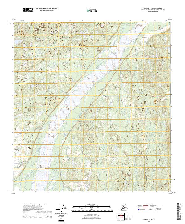
2023 Map of Nabesna B-2 NE
USGS Topo · Published 2023About this map
The Chisana River dominates this landscape in the eastern interior, its broad channel and braided flow patterns carving a path through the southern reaches of the Wrangell-Saint Elias National Preserve. The map documents the intricate hydrography of the region, where tributaries like Edge Creek and Bruin Creek feed into the main river system. This 2023 survey illustrates the wilderness character of the Southeast Fairbanks area, characterized by complex wetlands and drainage patterns that define the remote terrain. The presence of the National Preserve boundary across the northern sections indicates a landscape managed for conservation and minimal development, preserving the natural state of these glacial and riverine environments as they exist in the early twenty-first century.
Find a feature on this map
8 named features on this map. Tap any name to fly to it.
Don’t see what you’re looking for? This feature index may not catch every label — zoom into the map to look around manually.
Map Details
Editions of this 2023 Nabesna B-2 NE Map
This is the sole edition of this map. No revisions or reprints were ever made.
Other maps of this area

1950 · Nabesna
USGS Topo · 1:250,000

1951 · Nabesna
USGS Topo · 1:250,000

1955 · Nabesna C-1
USGS Topo · 1:63,360

1955 · Nabesna C-2
USGS Topo · 1:63,360

1960 · Nabesna B-2
USGS Topo · 1:63,360

1960 · Nabesna
USGS Topo · 1:250,000

1960 · Nabesna B-1
USGS Topo · 1:63,360
2016 · Nabesna B-2 NE
USGS Topo · 1:25,000
2016 · Nabesna C-2 SE
USGS Topo · 1:25,000
2016 · Nabesna C-1 SW
USGS Topo · 1:25,000