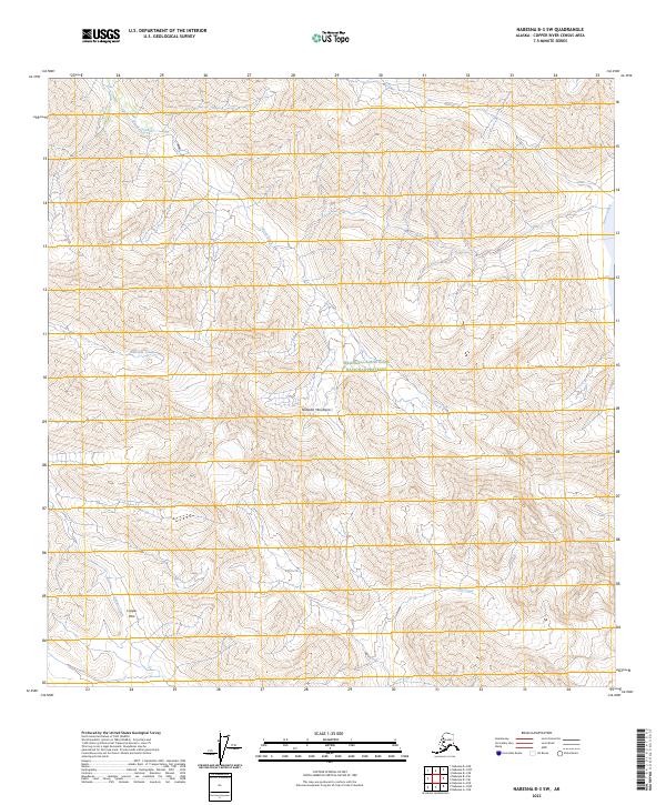
2023 Map of Nabesna B-3 SW
USGS Topo · Published 2023About this map
Wrangell-Saint Elias National Preserve encompasses most of this landscape, dominated by the high elevations of the Nutzotin Mountains. This high-country region is defined by sharp topographic relief and an intricate network of drainages. Several significant watercourses originate or flow through the area, including the winding Stone Creek and Ninemile Creek. In the southwestern portion of the sheet, Cooper Pass provides a notable transit point through the high terrain, situated near the headwaters of Cooper Creek. To the east, Star Creek and Stuver Creek further define the drainage patterns of these mountain slopes. The map reflects a contemporary record of this protected wilderness, documenting the precise contouring and hydrography of the Alaskan interior as it exists today, unmarred by roads or permanent settlements.
Find a feature on this map
12 named features on this map. Tap any name to fly to it.
Don’t see what you’re looking for? This feature index may not catch every label — zoom into the map to look around manually.
Map Details
Editions of this 2023 Nabesna B-3 SW Map
This is the sole edition of this map. No revisions or reprints were ever made.
Other maps of this area

1950 · Nabesna
USGS Topo · 1:250,000

1951 · Nabesna
USGS Topo · 1:250,000

1959 · Nabesna A-4
USGS Topo · 1:63,360

1960 · Nabesna B-4
USGS Topo · 1:63,360

1960 · Nabesna A-3
USGS Topo · 1:63,360

1960 · Nabesna
USGS Topo · 1:250,000

1960 · Nabesna B-3
USGS Topo · 1:63,360
2016 · Nabesna B-3 SE
USGS Topo · 1:25,000
2016 · Nabesna B-4 SE
USGS Topo · 1:25,000
2016 · Nabesna B-3 NE
USGS Topo · 1:25,000