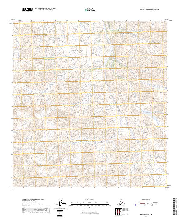
2023 Map of Nabesna B-4 SE
USGS Topo · Published 2023About this map
Wrangell-Saint Elias National Preserve encompasses much of this interior Alaska landscape, where the high ridges of the Wrangell Mountains meet the Nutzotin Mountains. The topography is defined by sharp elevation shifts and a drainage network that feeds into Blue Lake via Cooper Creek. This 2023 survey illustrates the modern boundaries and hydrography of the Copper River Census Area, showing the course of Ninemile Creek and Camp Creek as they navigate the steep northern slopes. The map serves as a contemporary record of these protected lands, where the absence of roads and human settlements highlights the region's character as a preserved wilderness at the height of the early twenty-first century.
Find a feature on this map
14 named features on this map. Tap any name to fly to it.
Don’t see what you’re looking for? This feature index may not catch every label — zoom into the map to look around manually.
Map Details
Editions of this 2023 Nabesna B-4 SE Map
This is the sole edition of this map. No revisions or reprints were ever made.
Other maps of this area

1950 · Nabesna
USGS Topo · 1:250,000

1951 · Nabesna
USGS Topo · 1:250,000

1959 · Nabesna A-4
USGS Topo · 1:63,360

1960 · Nabesna B-4
USGS Topo · 1:63,360

1960 · Nabesna A-3
USGS Topo · 1:63,360

1960 · Nabesna
USGS Topo · 1:250,000

1960 · Nabesna B-3
USGS Topo · 1:63,360
2016 · Nabesna A-4 NW
USGS Topo · 1:25,000
2016 · Nabesna B-4 NW
USGS Topo · 1:25,000
2016 · Nabesna B-4 SE
USGS Topo · 1:25,000