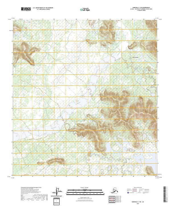
2023 Map of Nabesna C-1 SW
USGS Topo · Published 2023About this map
Alcan Border serves as the primary focal point of human settlement on this vast landscape, situated near the northeastern edge of the Tetlin National Wildlife Refuge. The terrain is defined by the significant course of the Chisana River, which winds through the central and western portions of the quadrangle. High ground rises to the northwest in the Black Hills, while the lowlands are marked by the intricate hydrology of Mirror Creek and numerous unnamed wetlands. This survey illustrates the protected status of the wildlife refuge, showing how the administrative boundaries of t10n r21e and t9n r22e encompass a rugged interior dominated by glacial-fed river systems and expansive muskeg. The map documents the relationship between the international border transit point and the surrounding wilderness environment in the eastern reaches of the Southeast Fairbanks Census Area.
Find a feature on this map
11 named features on this map. Tap any name to fly to it.
Don’t see what you’re looking for? This feature index may not catch every label — zoom into the map to look around manually.
Map Details
Editions of this 2023 Nabesna C-1 SW Map
This is the sole edition of this map. No revisions or reprints were ever made.
Other maps of this area

1950 · Nabesna
USGS Topo · 1:250,000

1951 · Nabesna
USGS Topo · 1:250,000

1955 · Nabesna C-1
USGS Topo · 1:63,360

1955 · Nabesna C-2
USGS Topo · 1:63,360

1960 · Nabesna B-2
USGS Topo · 1:63,360

1960 · Nabesna
USGS Topo · 1:250,000

1960 · Nabesna B-1
USGS Topo · 1:63,360
2013 · Nabesna C-1 NE
USGS Topo · 1:25,000
2016 · Nabesna C-2 NE
USGS Topo · 1:25,000
2016 · Nabesna B-2 NE
USGS Topo · 1:25,000