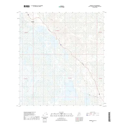
2017 Map of Nabesna D-2 NE
USGS Topo · Published 2017About this map
Northway Junction stands at the northern edge of this Alaskan interior landscape, where the Alaska Highway cuts through a dense network of wetlands and river systems. The Chisana River dominates the hydrology of the area, winding through a low-lying valley filled with numerous lakes and secondary streams like Mark Creek and Charlieskin Cr. The terrain is defined by its transition from these saturated river bottoms to the rising elevations of the surrounding hills, which frame the western and eastern edges of the valley.
Find a feature on this map
19 named features on this map. Tap any name to fly to it.
Don’t see what you’re looking for? This feature index may not catch every label — zoom into the map to look around manually.
Map Details
Editions of this 2017 Nabesna D-2 NE Map
This is the sole edition of this map. No revisions or reprints were ever made.
Other maps of this area

1949 · Tanacross
USGS Topo · 1:250,000

1950 · Tanacross
USGS Topo · 1:250,000

1950 · Nabesna
USGS Topo · 1:250,000

1951 · Nabesna
USGS Topo · 1:250,000

1952 · Nabesna D-1
USGS Topo · 1:63,360

1952 · Tanacross A-1
USGS Topo · 1:63,360

1954 · Tanacross A-2
USGS Topo · 1:63,360

1954 · Nabesna D-2
USGS Topo · 1:63,360

1955 · Tanacross A-2
USGS Topo · 1:63,360

1955 · Nabesna D-2
USGS Topo · 1:63,360