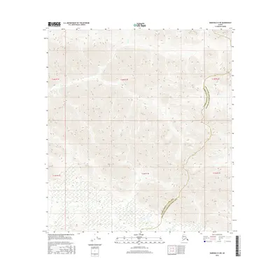
2016 Map of Nabesna D-5 NE
USGS Topo · Published 2016About this map
Moose Cr and Trail Cr carve through the high-altitude terrain of the Alaska interior in this 2016 survey. The landscape is defined by its administrative boundaries rather than human settlement, as the line between the Valdez-Cordova Census Area and the Southeast Fairbanks Census Area runs through the eastern portion of the quadrangle. The map illustrates a wilderness characterized by steep topographic gradients and complex drainage patterns, with various township and range designations such as t14n r12e and t13n r12e marking the vast, undeveloped sections. This technical record provides a clear view of the natural watercourses and the jurisdictional divisions in a remote part of the state, serving as an essential reference for understanding the geographic layout of these two neighboring census areas.
Find a feature on this map
9 named features on this map. Tap any name to fly to it.
Don’t see what you’re looking for? This feature index may not catch every label — zoom into the map to look around manually.
Map Details
Editions of this 2016 Nabesna D-5 NE Map
This is the sole edition of this map. No revisions or reprints were ever made.
Other maps of this area

1948 · Tanacross A-4
USGS Topo · 1:63,360

1948 · Nabesna D-5
USGS Topo · 1:63,360

1948 · Tanacross A-5
USGS Topo · 1:63,360

1949 · Tanacross
USGS Topo · 1:250,000

1949 · Tanacross A-5
USGS Topo · 1:63,360

1950 · Tanacross
USGS Topo · 1:250,000

1950 · Nabesna
USGS Topo · 1:250,000

1950 · Nabesna D-5
USGS Topo · 1:63,360

1951 · Nabesna
USGS Topo · 1:250,000

1952 · Tanacross A-4
USGS Topo · 1:63,360