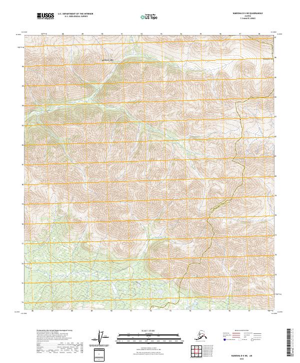
2023 Map of Nabesna D-5 NE
USGS Topo · Published 2023About this map
Mentasta Lake sits at the headwaters of a high-elevation drainage system where the Copper River and Southeast Fairbanks Census Areas meet. This interior landscape is defined by the sharp topographical transitions around Meiklejohn Pass, a natural gateway in the mountain range that has historically influenced movement through the region. The drainage patterns are clearly delineated by the winding paths of Trail Creek, Mice Creek, and Moose Creek, which carve through the steep contour lines. The map captures the administrative complexity of the Alaskan interior, showing the intersection of several townships and ranges including t14n r12e and t13n r13e. This 2023 survey provides a clear view of the hydrological and elevation data essential for navigating this part of the Nabesna quadrangle.
Find a feature on this map
12 named features on this map. Tap any name to fly to it.
Don’t see what you’re looking for? This feature index may not catch every label — zoom into the map to look around manually.
Map Details
Editions of this 2023 Nabesna D-5 NE Map
This is the sole edition of this map. No revisions or reprints were ever made.
Other maps of this area

1948 · Tanacross A-4
USGS Topo · 1:63,360

1948 · Nabesna D-5
USGS Topo · 1:63,360

1948 · Tanacross A-5
USGS Topo · 1:63,360

1949 · Tanacross
USGS Topo · 1:250,000

1949 · Tanacross A-5
USGS Topo · 1:63,360

1950 · Tanacross
USGS Topo · 1:250,000

1950 · Nabesna
USGS Topo · 1:250,000

1950 · Nabesna D-5
USGS Topo · 1:63,360

1951 · Nabesna
USGS Topo · 1:250,000

1952 · Tanacross A-4
USGS Topo · 1:63,360